Climate-Smart Finca
Resilient Finca Design
A site-specific assessment and design that prepares your land for hotter summers, longer dry periods and heavier storms — and gives you a clear plan before you spend money on individual measures.
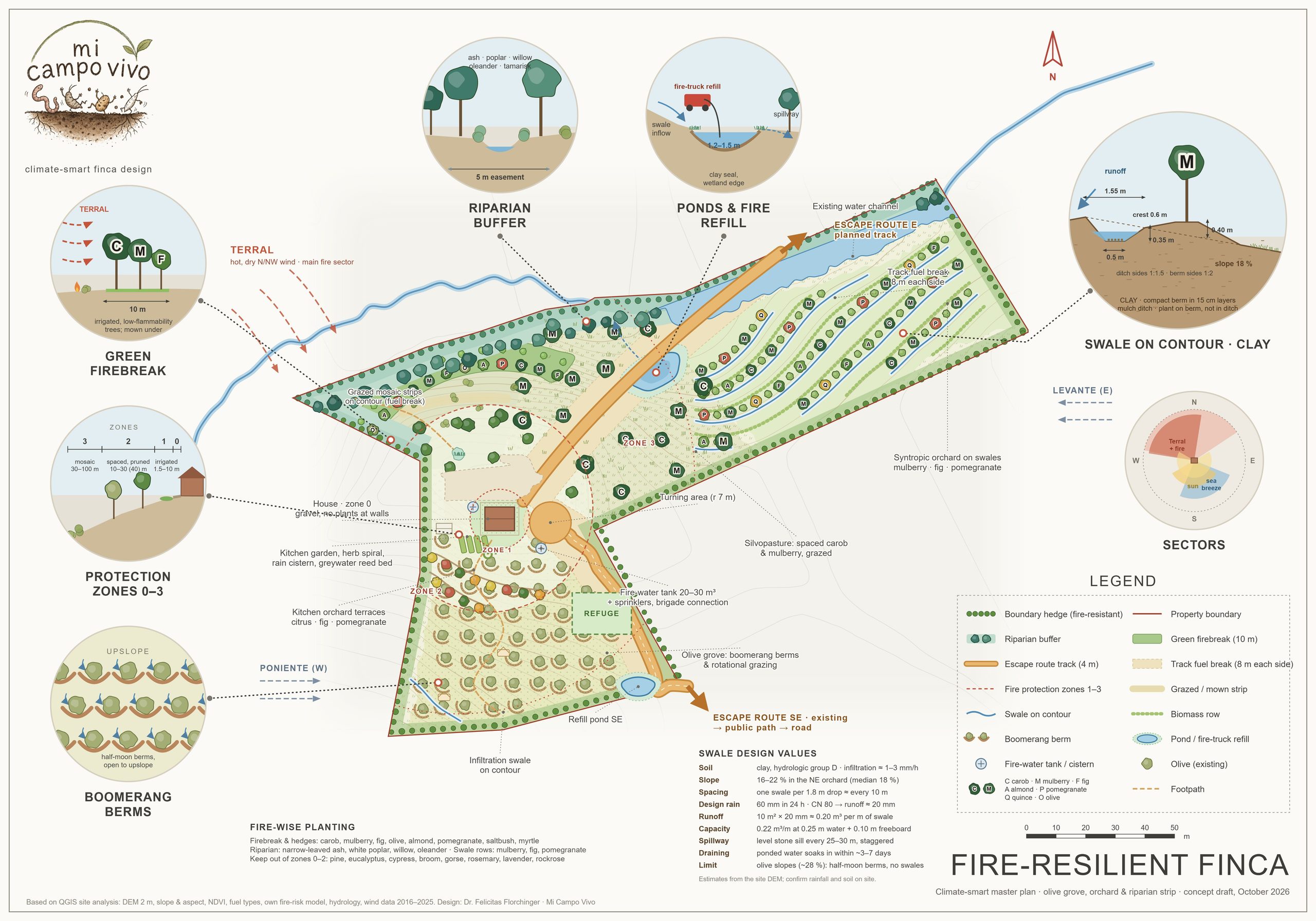
Why plan first
Many fincas carry the traces of well-meant but disconnected decisions: trees planted where water never reaches them, terraces that channel runoff instead of holding it, irrigation that compensates for soil that cannot store water, vegetation cleared in one place and left to build up in another.
An integrated plan looks at the whole property before anything is built or planted. It identifies what the land is already doing, where the real risks and opportunities lie, and which interventions should come first. That usually saves money — and years.
What the assessment looks at
- Drought and heat Which parts of the land suffer most in summer, and why.
- Rainfall and storms How intense rain behaves on your slopes and where it goes.
- Runoff and erosion Where soil is being lost and where water could be slowed.
- Soil and water retention The condition of the soil and its capacity to store water.
- Slope and terrain Steepness, aspect, valley lines and ridges from terrain data.
- Wind and sun Exposure that affects plants, people and fire behaviour.
- Vegetation and planting What grows now, what is worth keeping, what could be added.
- Fire exposure Fuel, slope and access around buildings and across the property.
- Land use and zoning Which areas suit house garden, orchard, grazing, woodland or rest.
- Long-term resilience How the property can stay productive and manageable over decades.
What a design can include
The content of each design is agreed in advance and depends on your property and your questions. It may include:
There is no fixed package. After an initial conversation I propose a scope and a quote for your specific property.
- A written site assessment
- Analysis maps: terrain, slope, water flow and exposure
- Functional zoning of the property
- Recommended interventions for water, soil and fire risk
- A planting strategy suited to the site
- A phased implementation plan with priorities
How a map becomes a design decision
An illustrative hillside, not a client property. Step through the layers to see how terrain, water and fire exposure lead to concrete choices.
Read the terrain
Contour lines show where the slope is steep and where it is gentle. Where they bend uphill, there is a valley line — the place water will gather.
Follow the water
Rain runs downhill at right angles to the contours and concentrates in the valley line. That is where erosion starts and where the most water can be slowed and soaked in.
Look at fire exposure
Fire tends to move faster uphill, and dense dry scrub below a house adds to the exposure. Access, vegetation and slope are read together.
Decide what goes where
Lower-fuel, well-tended ground around the house. Planting and soil cover along the contours on the gentler slopes. The valley line kept vegetated and slowed only where the site allows. Each choice follows from the layers before it.
Illustrative example drawn for this website.
Plan your finca before you build or plant
Tell me about your land and what you want from it.